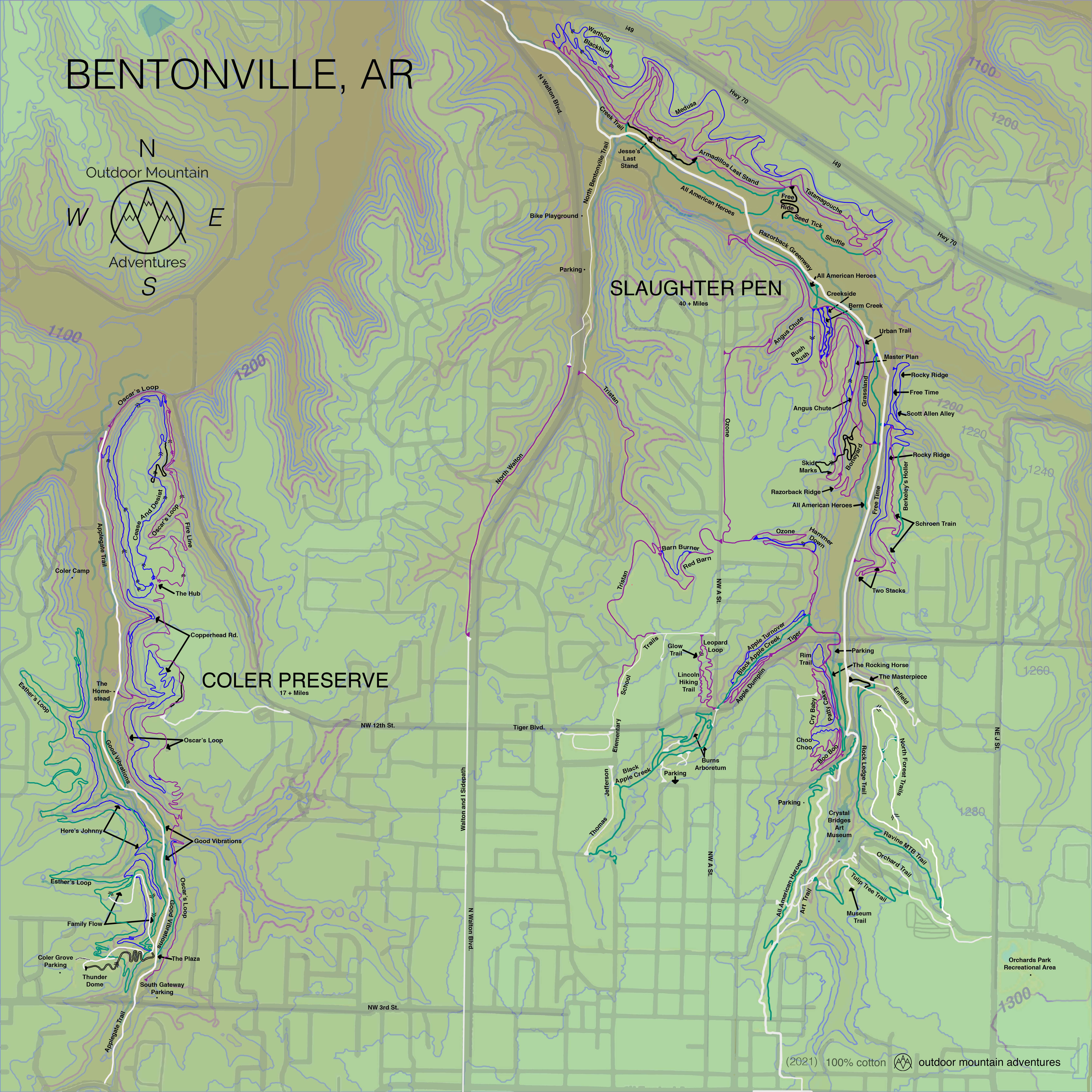
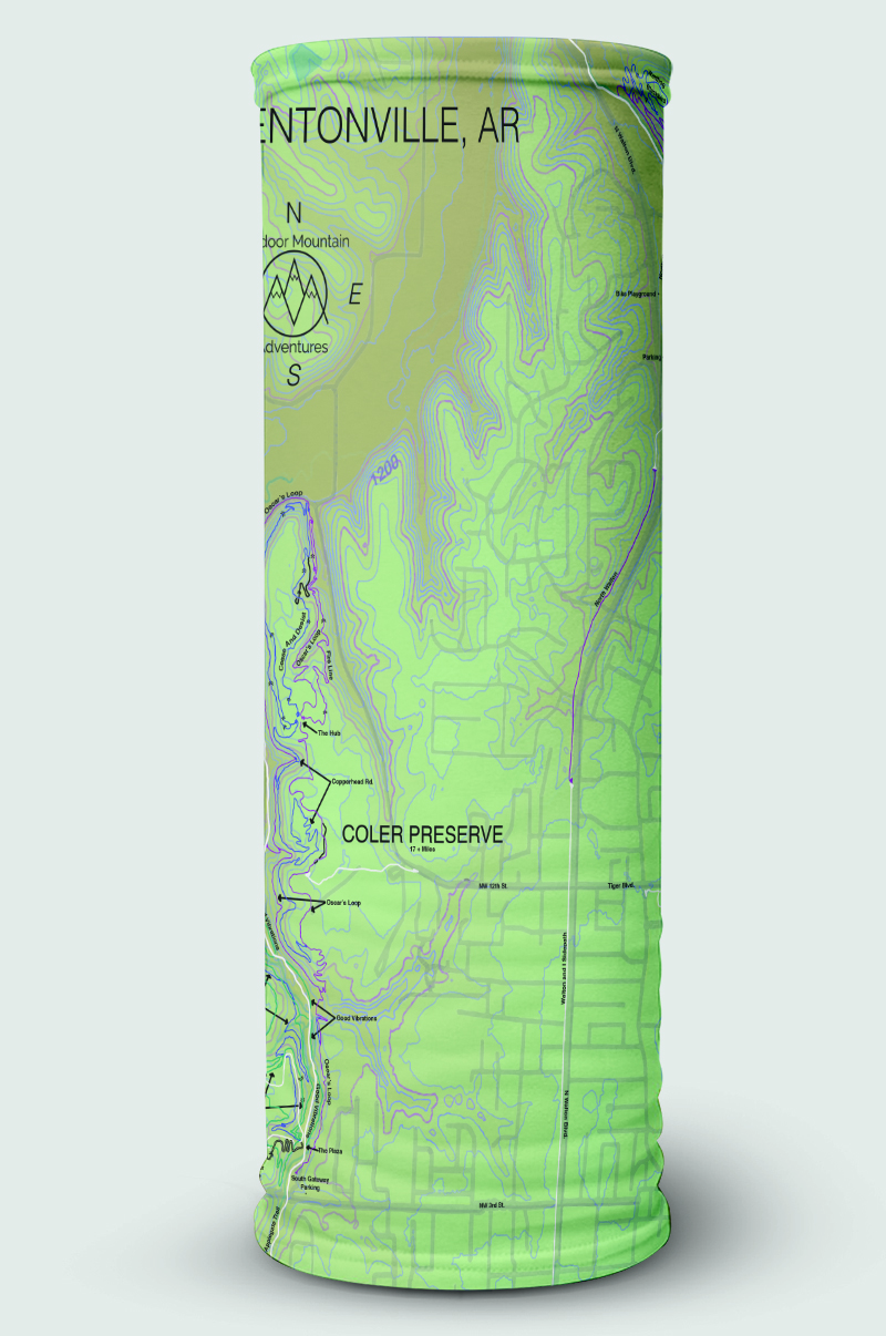
Bandana
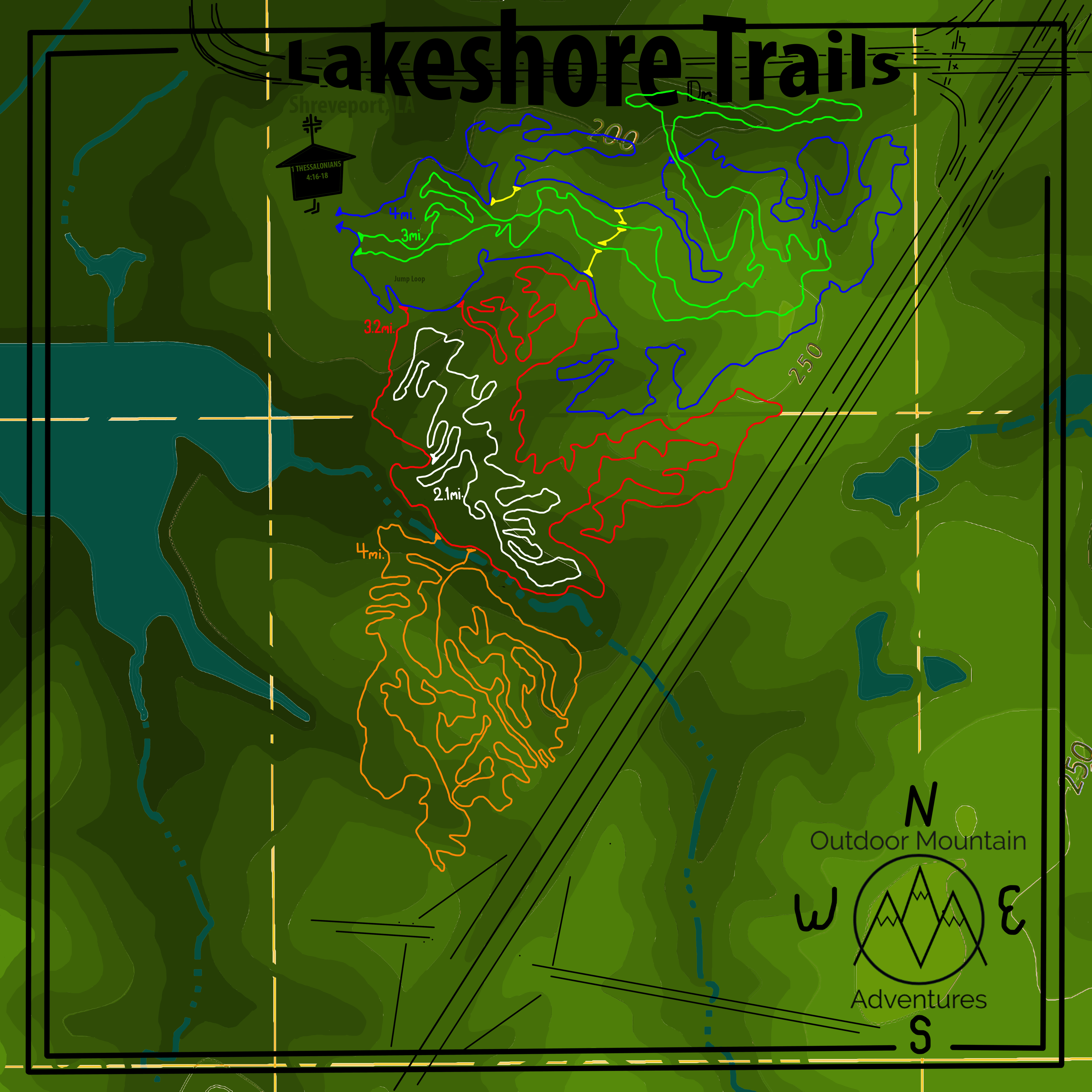
Slaughter Pen and Color Mt. - Bentonville, AR - Bandana
OMA Bandana Map - 22" x 22" - Topography - 100% Cotton - by OMA
$20.00
Maps
Stickers
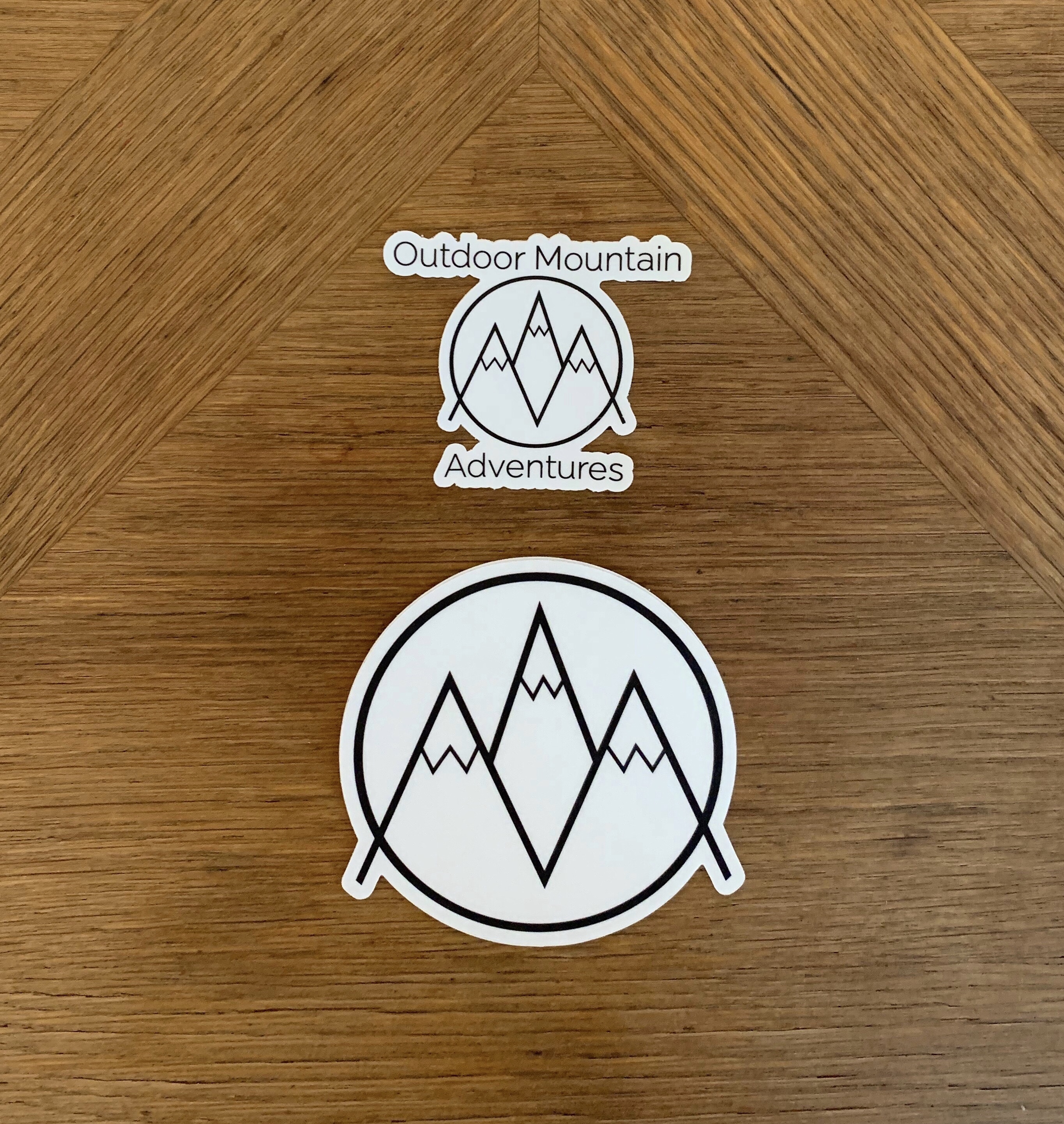
Stickers
Pick a pair of stickers. Our classic sticker paired another sticker of your choosing for just $5.00.
$5.00
Maps
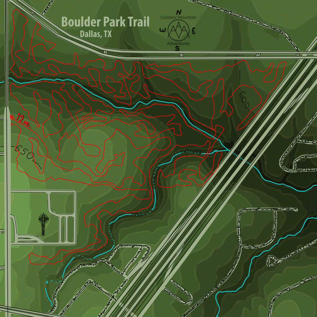
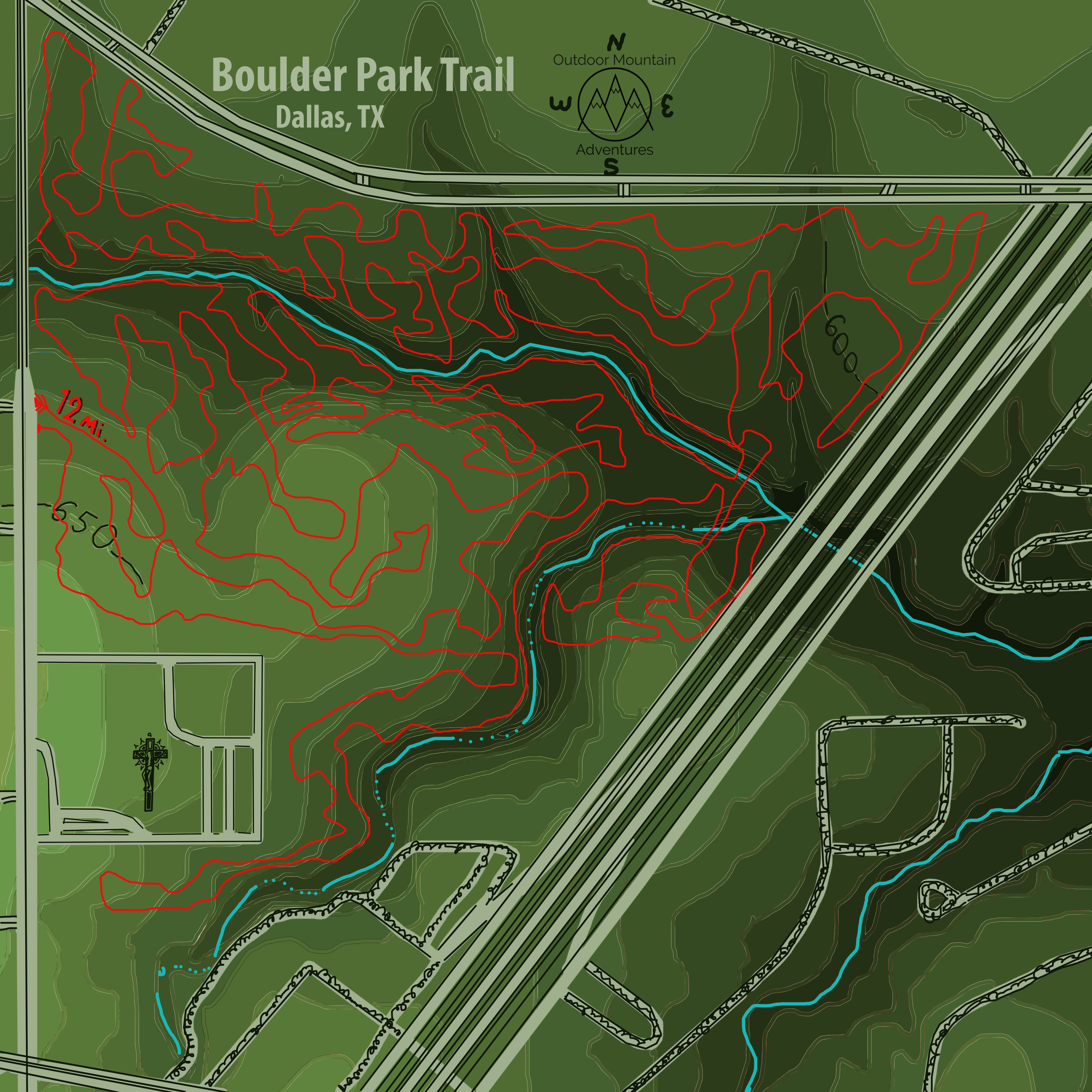
Boulder Park (Dallas, TX) Bandanna Map
A 100% cotton bandana with topography and Boulder Park Trail printed on it
$25.00
Maps
Maps
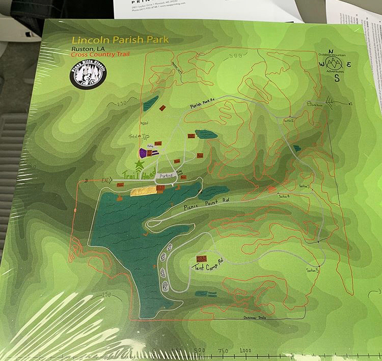
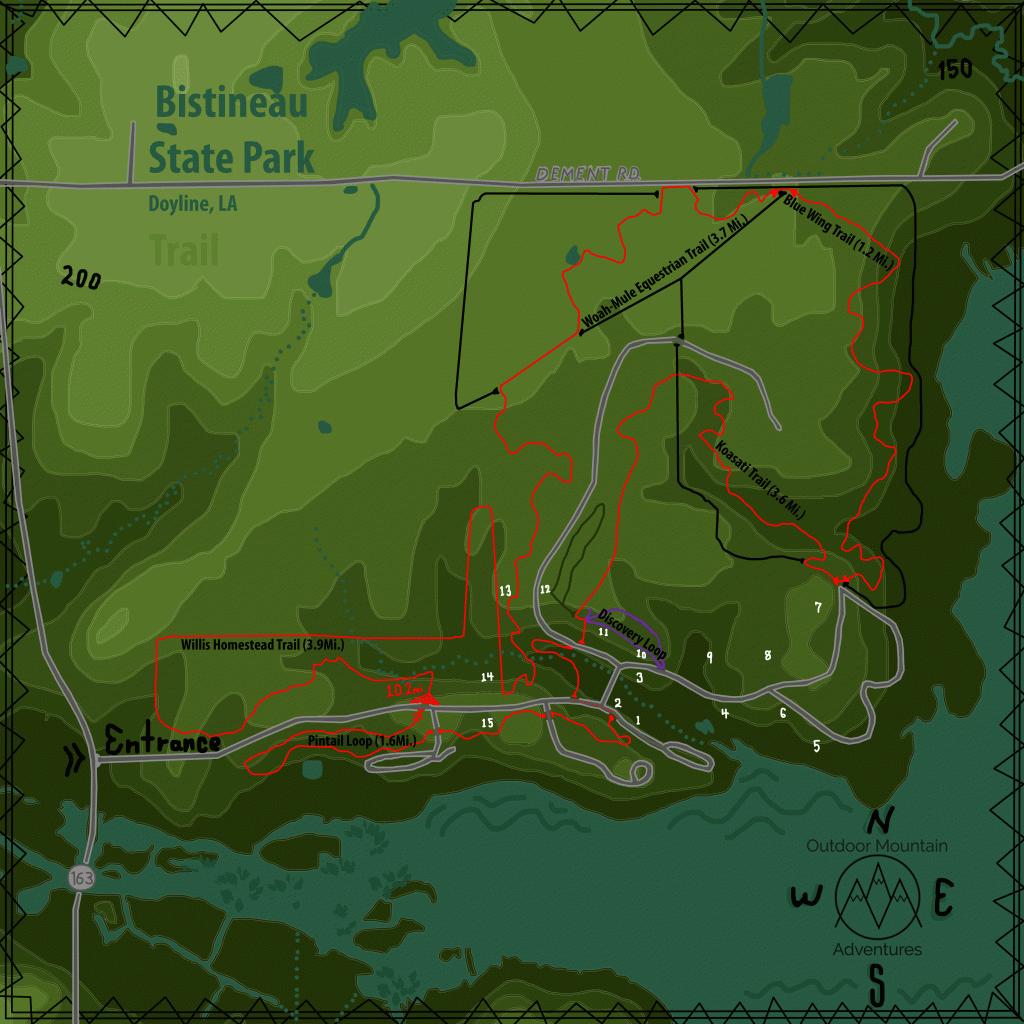
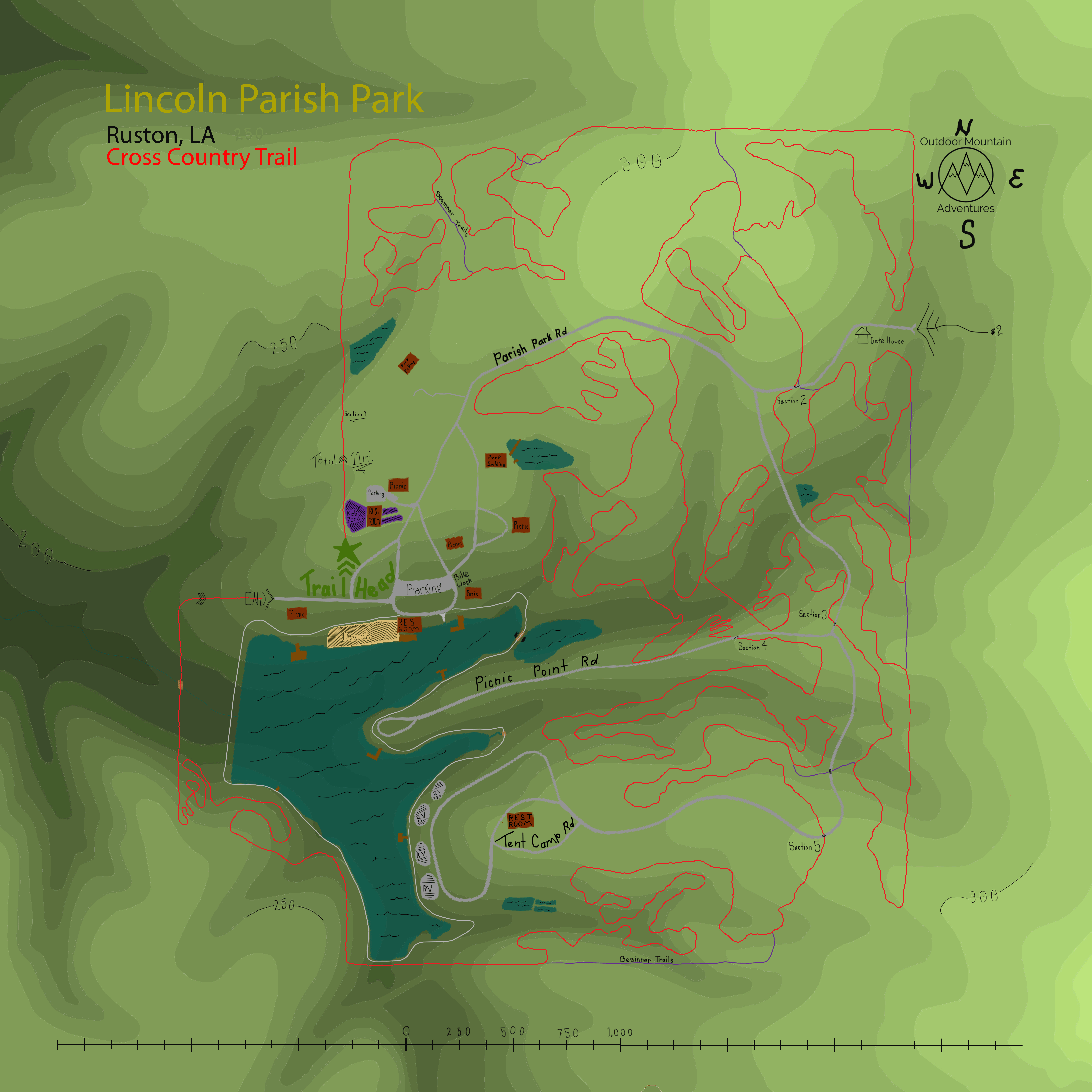
Lincoln Parish Park (Ruston, LA) Bandana Map
100% cotton bandanna with a print of the trail map over topography eloquently printed edge to edge.
$25.00
Maps
Maps

Maps